Lifetime Authenticity Guarantee
The WW2 British RAF Midlands North Map, measuring 23 inches by 32.5 inches, is an original cartographic artifact produced for operational use during the Second World War. Designed for the Royal Air Force, this map covers the northern section of the Midlands region of England, a strategically significant area during the conflict due to its industrial infrastructure and airfields. The map features detailed topographical information, including major towns, railways, airfields, and geographic features relevant to RAF navigation and mission planning. Cartographic symbols and color coding are utilized to enhance clarity and quick reference, aligning with wartime standards for ease of use under operational conditions. Such maps were integral to flight crews for both training and active missions, contributing to air operations over the United Kingdom and continental Europe. This piece reflects the technological and logistical efforts underpinning RAF activities during World War II. It is intended for collectors, historians, and educational reference.

WW2 British RAF Midlands North Map 23″ X 32 1/2″
$100.00
Availability: Only 1 left in stock
Related products
-
WW2 Militaria
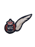
WW2 New Zealand Air Force RNZAF Wireless Air Gunner WAG Wing Padded
$125.00 Add to cart