Lifetime Authenticity Guarantee
The WW2 British RAF England South Map measures 23 by 32 1/2 inches and presents a detailed cartographic representation of southern England as used by the Royal Air Force during the Second World War. This map typically includes features such as airfields, major towns, transportation routes, and geographic landmarks relevant to wartime navigation and operations. Printed with clear, legible markings, it was designed to assist aircrews in mission planning and in-flight navigation across critical regions of England. Such maps played a vital role in RAF operations, supporting both defensive and offensive missions over Britain and continental Europe. The map’s scale and details reflect the period’s cartographic standards and the practical requirements of aerial operations. An artifact like this provides valuable insight into the logistical framework and navigational challenges faced by the RAF. It is a significant reference for military historians, collectors, and those interested in WWII aviation history.

WW2 British RAF England South Map 23″ X 32 1/2″
$100.00
Availability: Only 1 left in stock
Related products
-
WW2 Militaria
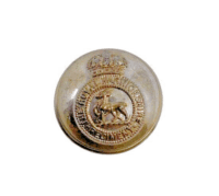
WW2 British Royal Warwickshire Regiment Officers Large Size Jacket Button
$15.00 Add to cart