Lifetime Authenticity Guarantee
This item is a World War II-era map used by the British Royal Air Force, depicting the North West region of England. Measuring approximately 23 inches by 32 1/2 inches, the map provides detailed geographical and topographical information relevant to military operations during the period. Such maps were essential tools for navigation and mission planning, offering a clear representation of towns, infrastructure, natural features, and strategic points within the specified area. Markings and captions are consistent with period-appropriate cartographic standards, and the scale is suitable for operational use by aircrews. The map reflects the technological and logistical needs of the RAF during the Second World War, highlighting critical locations that may have held military significance. As an artifact, it provides insight into the tools and methods utilized by Allied forces in the European theater. This map is intended for historical reference, research, and collection by those interested in military history and cartography.

WW2 British RAF England North West Map 23″ X 32 1/2″
$100.00
Availability: Only 1 left in stock
Related products
-
WW2 Militaria
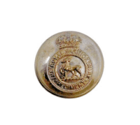
WW2 British Royal Warwickshire Regiment Officers Large Size Jacket Button
$15.00 Add to cart