This historic artifact is a World War II era map titled “WW2 British Canadian War Office 1943 Map of Colembert, France,” designated as Sheet 49. Produced in 1943 by the British and Canadian War Offices, this detailed map measures approximately 24×19 inches and offers an invaluable glimpse into the geographical and strategic considerations of the period. Designed for military planning and operations, this map includes intricate details of the Colembert area in France, capturing both natural and man-made features essential for wartime navigation and strategy. The reverse side of the map is plain, preserving the authenticity and integrity of the wartime document. Ideal for historians, collectors, and enthusiasts of World War II memorabilia, this map represents a significant piece of military history, shedding light on the collaboration and meticulous planning between British and Canadian forces during a pivotal time in the war.
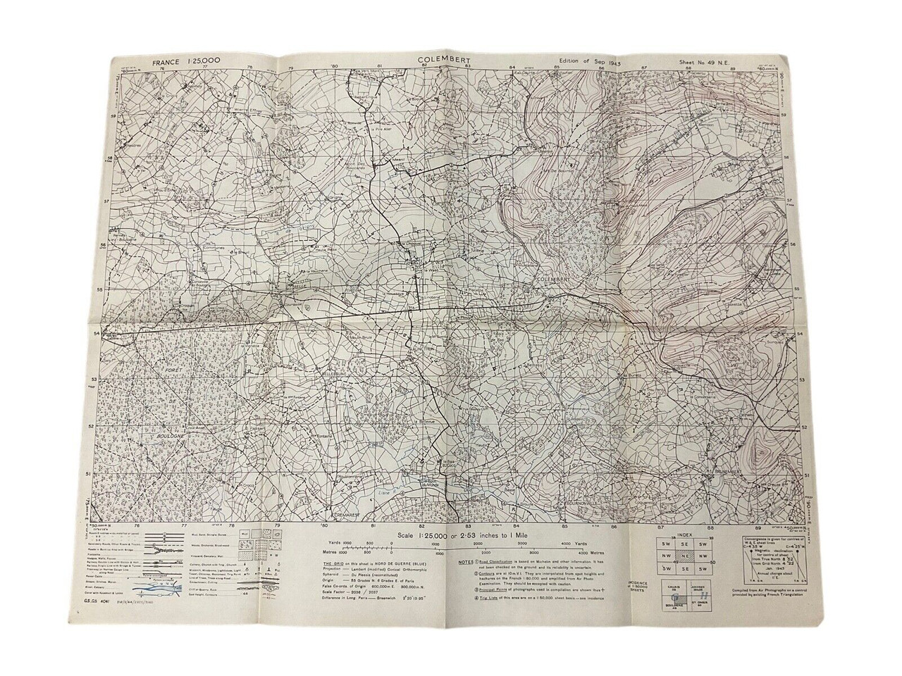
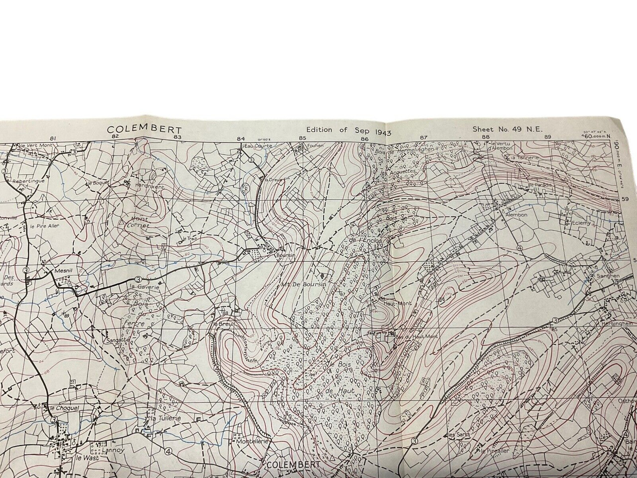
WW2 British Canadian War Office 1943 Map Of Colembert France Sheet 49 Size 24×19
$15.00
WW2 British Canadian War Office 1943 Map Of Colembert France Sheet 49 Size 24×19 inches appx, plain reverse.
Out of stock
| Conflict | WW II (1939-45) |
|---|---|
| Country | Canada |
| Original/Reproduction | Original |
| Theme | Militaria |